2008 Marek Fire
 Updated map from 9pm.
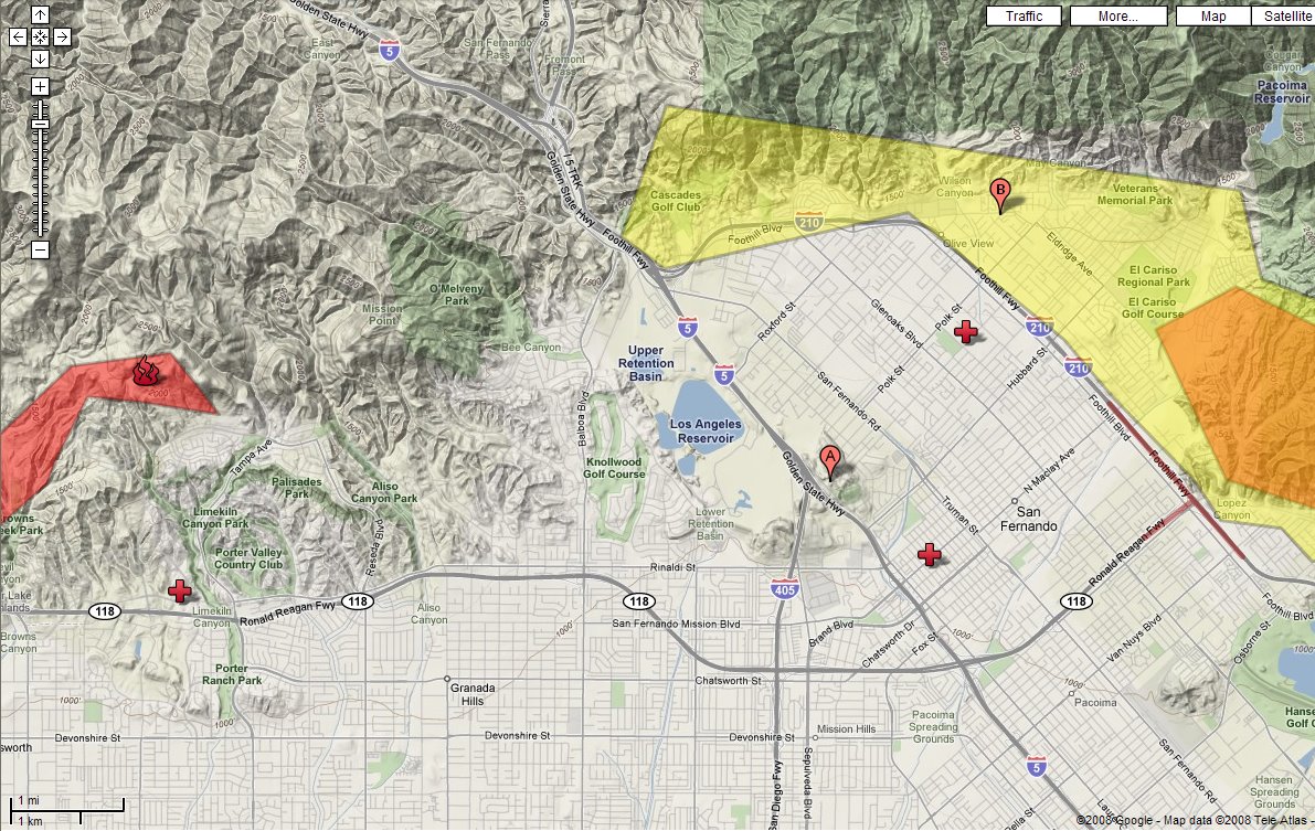
 Added a flag (B) to show the Escoto's house (inside the evacuation zone)
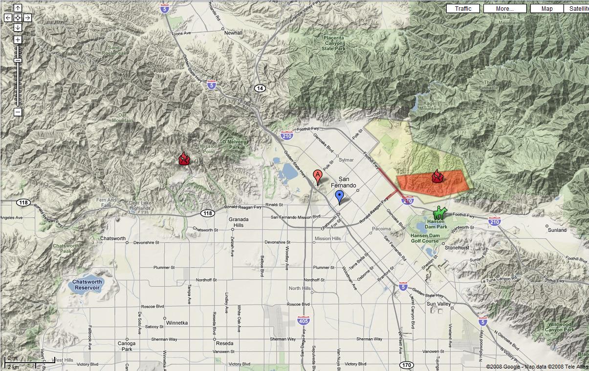
Here's the current Google map showing our house (the A-flag in the middle) and the fires on both sides (Newer Porter Ranch fire on the left and 2-day old Marek fire on the right). We can see (and smell) the smoke around us, but we're about 2-3 miles in from the edge of the foothills, so it's hard to imagine it coming this far into the valley from either side.
The blue flag on the map (just down the street from us) is the evacuation center, and the green horse graphic is an equestrian and livestock evacuation center at Hansen Dam (where Tami did her first triathlon).
The Marek fire was mostly contained by late yesterday, but last night we had winds up to 70mph and now the fire is out of control again.
posted by Jeff at
12:00 PM
![]()

4 Comments:
Wow! We didn't realize there were two of them nor that close to you. I would tend to think you are correct -- hard to imagine coming that far into the valley. We'll keep good thoughts and also keep an eye on you. Ugg -- smoke! Thanks for the map and details. That really helps us.
By FAN, At
October 13, 2008 5:17 PM
FAN, At
October 13, 2008 5:17 PM
Update - The Escoto's (Aunt Karen, Uncle Dave and 3 cousins) are on evacuation standby as of 9pm on Monday. The fire is about 1 mile from their house and getting closer. They have already been warned to "be ready to leave".
On the map, they're located near the 210 freeway and Polk (NE of our house).
By Jeff, At
October 13, 2008 9:17 PM
Jeff, At
October 13, 2008 9:17 PM
How terrible. Try to keep us posted, Jeff. We have you all in our thoughts.
By FAN, At
October 13, 2008 10:00 PM
FAN, At
October 13, 2008 10:00 PM
How frightening! I guess it all ended well as it's gone silent ... right?
By sylvia, At
November 5, 2008 11:29 AM
sylvia, At
November 5, 2008 11:29 AM
Post a Comment
<< Home